

Communities
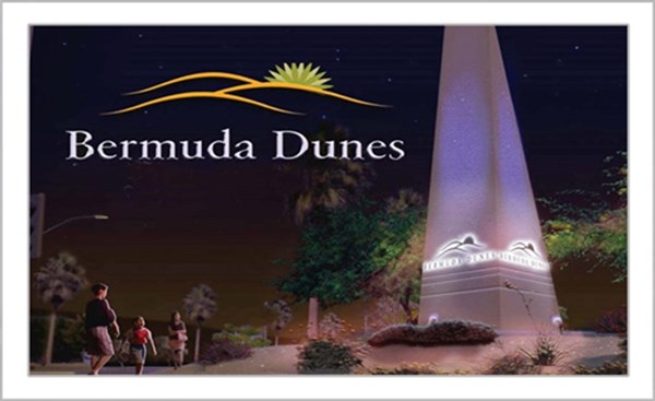
Bermuda Dunes
South of Interstate 10 and east of Washington Street, Bermuda Dunes is a busy residential community of 7,282. This community is known for its large estate-style homes and the Bermuda Dunes Country Club. Bermuda Dunes is home to a general-aviation airport, and, as such, it provides a habitat for such diverse interests as airplanes, horses, and golf.
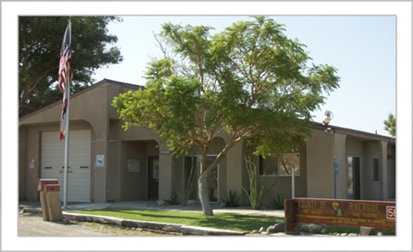
To reserve the Bermuda Dunes Community Center, please contact Desert Recreation District at (760) 347-3484.
Boundary Map | Bermuda Dunes Design Guidelines
Chiriaco Summit
For years, a watering hole for motorists, Chiriaco Summit is a fully-contained community, complete with gas station, sit-down and fast food restaurants, mobile home park and water company. Until a few years ago powered by diesel generators, Chiriaco Summit now enjoys electrical service from the Imperial Irrigation District. Not far from the Cottonwood Canyon entry into Joshua Tree National Park, Chiriaco Summit is a beautiful desert nook, surprisingly off the beaten path—considering it serves the ever-rumbling traffic of Interstate 10.
Colorado River Communities
Stretching along the Colorado River north of Blythe are several mobile home parks, which are banded together loosely as the Colorado River Communities. A popular senior center is located there, but the crowd is much younger on the weekends and holidays as the jet ski and boating set hits town. Winter or summer, with the warm weather and the nearby river, the Colorado River Communities continue to flourish.
Desert Center, Lake Tamarisk and Eagle Mountain
In the center of the Fourth District are Desert Center, Lake Tamarisk and Eagle Mountain. Desert Center is at the crossroads of Interstate 10 and State Highway 177, and things get pretty busy on the weekends as travelers to the Colorado River stop in for gas and refreshments. Lake Tamarisk is a surprising oasis just north of Desert Center, complete with 9-hole golf course, clubhouse, lake, fire station (staffed 24/7 with paramedics) and library. The social scene gets very active during the winter months. Eagle Mountain, which flourished for decades as the “company town” at the foot of the Kaiser iron ore mine, is very close to a ghost town with the cessation of mining operations back in the 1980s. That doesn’t keep the movers and shakers from attempting to attract job and revenue-producing enterprises, and those enterprises keep giving Eagle Mountain a look.
Desert Edge
On the western edge of the Fourth District, the community of Desert Edge is an immediate neighbor to the City of Desert Hot Springs to the west. Desert Edge is home to the famous hot water that makes this region a favorite wintering spot of snowbirds and others seeking the therapeutic benefits of its mineral spas. Many mobile home and RV Parks and facilities call Desert Edge home, and its residents take full advantage of the hot mineral springs, the warm winter weather, and the thousands of reunions that take place each winter.
Boundary Map | Desert Edge Design Guidelines
Desert Palms
The Desert Palms boundary comprises Sun City Palm Desert, the new Domani Palm Desert community and nearby businesses. The bulk of the population is bustling 55+ Sun City Palm Desert, but the nearby shopping and dining facilities have enhanced the quality of life. Desert Palms is bordered by Thousand Palms on the west, Interstate 10 on the south and the City of Indio on the east.
Indio Hills
Indio Hills is only a few miles north of the Coachella Valley’s biggest city, from which it gets its name. Bordered on the north by Joshua Tree National Park, and on the south by the Coachella Valley Preserve, the unspoiled desert views take your breath away. If you like laid-back desert living, you’ll love Indio Hills. With large lots, and open spaces everywhere, Indio Hills carefully guards its rural lifestyle. The new community center and improvements to the adjacent park are welcome additions for local residents to get together.
To reserve the Indio Hills Community Center, please contact Desert Recreation District at (760) 347-3484.
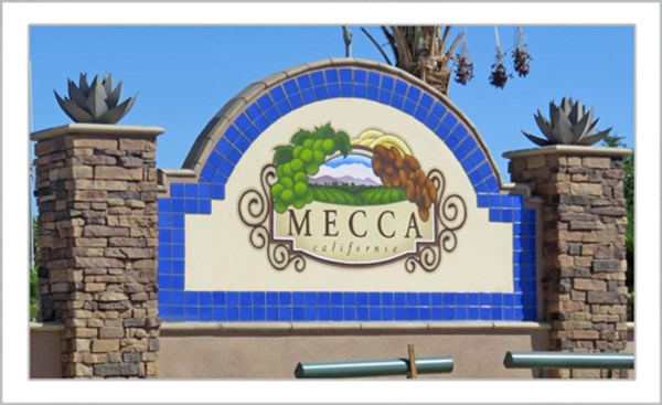
Mecca
Named after the ancient Saudi Arabian holy city following a trip to the Middle East by a group studying the date industry, the town of Mecca, southeast of Indio, has a population of 8,577, the largest unincorporated community in the Fourth District. One of the most impoverished communities in the United States, Mecca had been in desperate need of revitalization. Since 2003, the county has invested $54.6 million in public works to bring a new look to downtown Mecca, providing new business opportunities and increasing access to public services.
Boundary Map | Mecca Design Guidelines
Mesa Verde
Mesa Verde is a primarily mobile home community of some 1200 residents, situated on the “Upper Mesa” just west of the City of Blythe. While the community has changed little over the years, there has been a flurry of activity lately.
The potential of the Blythe Airport right across the freeway from Mesa Verde, and an abundance of affordable land in the area, make Mesa Verde a distinct candidate for future development. One of the largest, most-productive citrus orchards in the desert is on the eastern flank of the community.
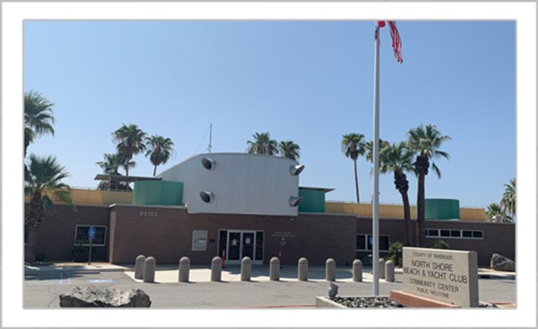
North Shore
North Shore is seeing a burgeoning population of young families new to the area, and they are very keen on quality of life issues. The North Shore Beach & Yacht Club was renovated in 2010 by the Riverside County EDA. This historic yacht club now serves as a community center, adding to the quality of life for local residents. The Salton Sea State Park is also located in North Shore and provides free community events including various holiday activities, kayaking and bird walks.
Oasis
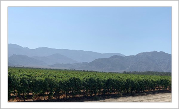
If the State of Montana hadn’t already taken the motto “Big Sky Country,” it would certainly be fitting for the community of Oasis. Stretching several miles between the majestic Santa Rosa Mountains on the west and the Salton Sea on the east, from the community of Vista Santa Rosa to the Imperial County line, Oasis is a vast agricultural, ahem, oasis. A new elementary school is in the works, but even bigger things are on the horizon. Oasis lays claim to some very significant historical resources in the “fish traps” used by the first residents of the area, and the etched-in-stone shoreline of the ancient Lake Cahuilla.
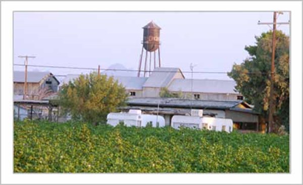
Ripley
One of the oldest communities in the desert, Ripley is a small population center in a vast agricultural region of the southern Palo Verde Valley. Ripley has the distinct advantage of having some of the best views in Southern California, with waves of green crops and rustic farm houses providing a colorful foreground to the rugged desert mountains in the distance.
Sky Valley
To the west of Indio Hills, Sky Valley is another hamlet with residents enjoying a rural desert lifestyle. Residents enjoy quiet, dark skies and visits from desert wildlife. Popular activities include hiking and horseback riding.
Boundary Map | Sky Valley Community Center | Sky Valley Home Owner Association
County Service Area 104 (Sky Valley) was established in 1974 for road maintenance and road improvement services. These services are funded by a special assessment paid by and exclusively for the benefit of the residents of Sky Valley. To find out if you live within CSA 104's special assessment and benefit area, click on the link below to view the map:
County Service Area 104 Map
Thermal
The community of Thermal, southeast of Indio, is home to one of Riverside County’s largest airports, the Jacqueline Cochran Regional Airport. Necessary infrastructure – a new Sheriff’s station, roads, streets, sewers and a new fire station – is being constructed as part of the county’s $90 million investment in the community. New road, water, sewer and electrical lines created for some of these projects will be key catalysts to attracting businesses and further development in the region. To govern future development, Riverside County has created Thermal Design Guidelines to ensure a consistent “Thermal” look that reflects the area’s agricultural influence.
Thousand Palms
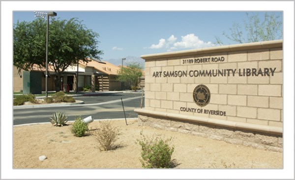
On the north side of Interstate 10 and Ramon Road, Thousand Palms is a vibrant community of 7,715, with many young families. No longer a sleepy village, Thousand Palms has several fast-food restaurants, new residential developments, a community center, a burgeoning industrial park, the Coachella Valley’s state-of-the-art Animal Campus, the brand new Art Samson Memorial Library, a new fire station combined with a College of the Desert fire training facility and newly-renovated thoroughfares, Varner Road and Monterey Avenue.
Vista Santa Rosa
Comprising some 21 square miles south of Indio and on the eastern flank of the City of La Quinta, Vista Santa Rosa is a quiet rural community with agriculture and equestrian pursuits among its primary assets. Polo aficionados internationally are attracted to this winter epicenter of equestrian activities. The County of Riverside has recently implemented a set of Design Guidelines to maintain the rural, country aesthetic of the community for decades to come
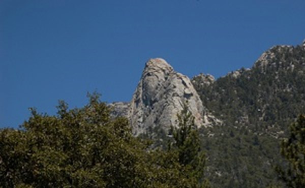
Idyllwild and the Mountain Communities
With county redistricting, the Fourth District has expanded to now include Idyllwild and Riverside County’s mountain communities. Supervisor Perez is proud to represent Idyllwild, Pine Cove, Fern Valley, Garner Valley, Mountain Center and Pinyon Pines. The Idyllwild community is the highest point of the county, and is a beautiful and unique place in Riverside County. Supervisor Perez and his staff is available to assist with county issues and we look forward to hearing from community members.